Geostationære:
Polar kredsløb:
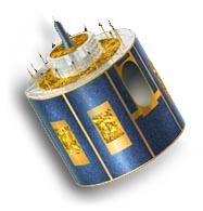
Meteosat Second Generation (MSG)
Meteosat-11: 0.°
Operatør: EUMETSAT
Type af orbit: Geostationære
Instrument: SEVIRI (spinning enhanced visible and infrared imager)
Antal spektrale bånd: 12
Opløsning på subsatellitpunkt: VIS/NIR: 1~3km, IR: 3km
Billeder tages med 15 minutters interval.
Billeder fra Europa tages for hver 5 minutter.

Meteosat-8: 41.5°E
Radiometer scanner jordens overflade linje for linje; hver linje består af en serie individuelle billedelementer eller pixels. For hver pixel måler radiometeret den radiative energi for diverse spektrale bånd. Denne måling kodes digitalt og sendes til jordstation for forbehandling inden den udsendes til brugerne.
Geostationære:
Polar kredsløb: